
Terence Eden on Nostr: I think I need some #geospatial help. I have a #GeoJSON file which is ~10MB. Even ...
I think I need some #geospatial help.
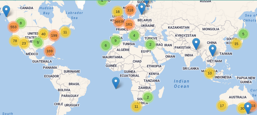
I have a #GeoJSON file which is ~10MB. Even when compressed it is about 2MB.
It provides a cluster of ~28k points displayed on a #Leaflet map.
Is there a sensible way to make this more efficient? Can I start will a small GeoJSON of just the clusters and then "stream" in more detailed files when users zoom in?