
Eugene Alvin Villar on Nostr: #30DayMapChallenge 🗺️ Day 2️⃣4️⃣: Only circular shapes ⭕ After ...
#30DayMapChallenge 🗺️ Day 2️⃣4️⃣: Only circular shapes ⭕
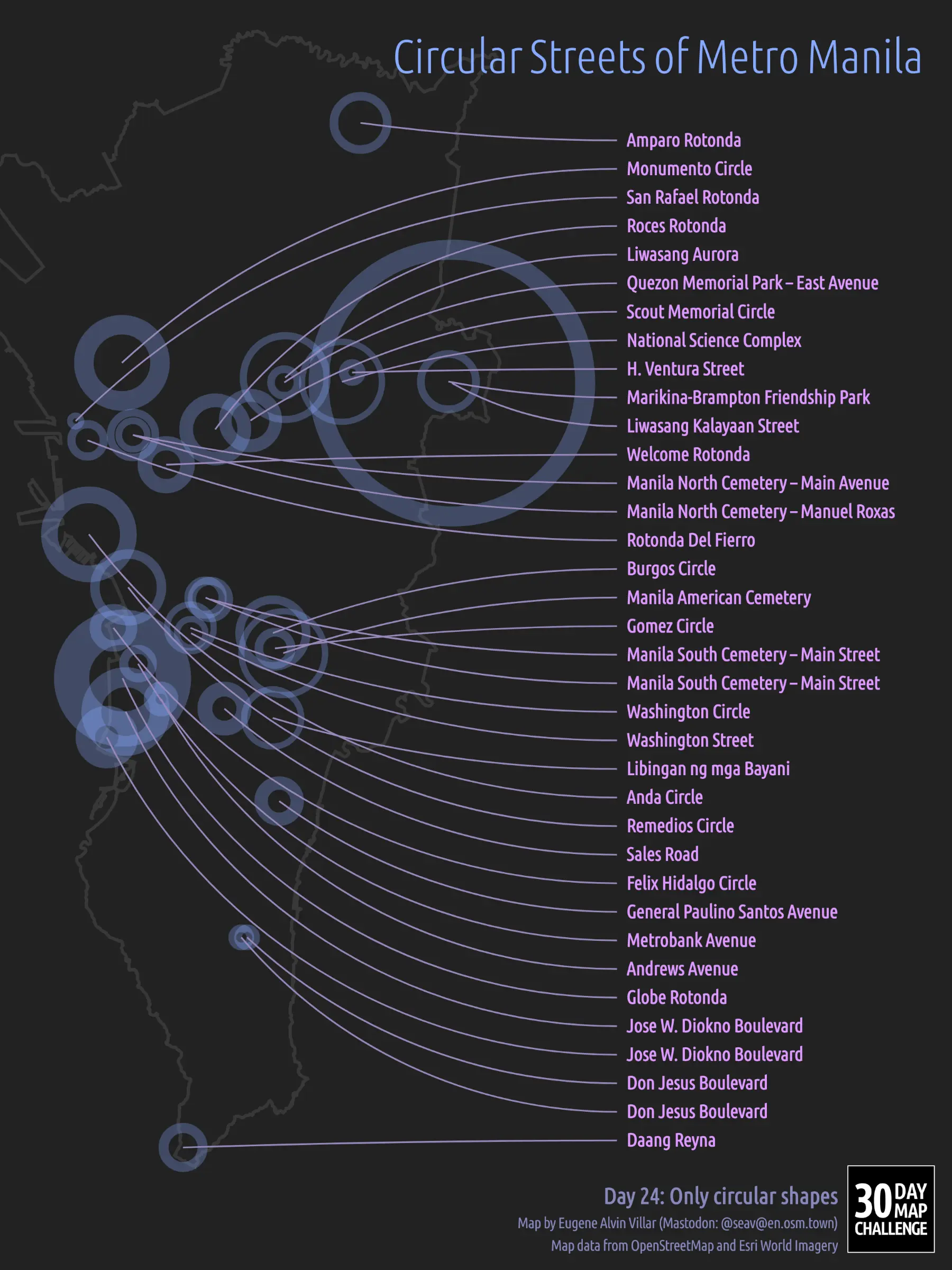
After considering other options, I went with depicting the circular streets of #MetroManila, #Philippines 🇵🇭, often called “circles” or “rotondas”. Each street’s center is placed on its exact location, but its radius and street width are scaled ~40×.
The streets and radii are from #OpenStreetMap while the street widths are measured using Esri’s World Imagery. The final image was rendered using #D3js and uses a Transverse Mercator projection.