Or M. Bialik on Nostr: We do field #geology with remotely operated vehicles (ROV) on Mars, so why not at the ...
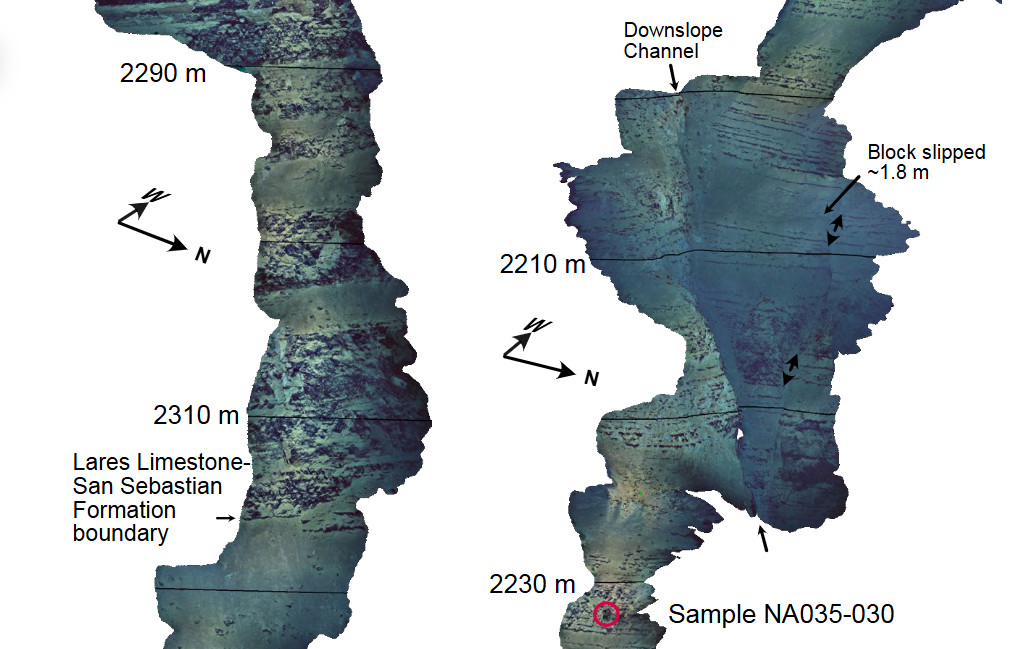
We do field #geology with remotely operated vehicles (ROV) on Mars, so why not at the bottom of the #Ocean? With a new method to turn imagery from ROVs ( #photogrammetry ) into #VirtualOutcrops, colleagues from the #USGS and I came back with some new ideas on the evolution of the Mona Rift near Puerto Rico.
https://doi.org/10.1130/GES02762.1 
Published at
2024-10-31 07:27:12Event JSON
{
"id": "ed71b56980753199c3dca88f6adab16ee5749979cb59ccc866aa727b74aa347a",
"pubkey": "b86894af7f544cdad086d4ec01384e91512f484914e6141795547f21268740dd",
"created_at": 1730359632,
"kind": 1,
"tags": [
[
"t",
"geology"
],
[
"t",
"ocean"
],
[
"t",
"photogrammetry"
],
[
"t",
"virtualoutcrops"
],
[
"t",
"usgs"
],
[
"proxy",
"https://mastodon.world/users/ombialik/statuses/113400848903236170",
"activitypub"
]
],
"content": "We do field #geology with remotely operated vehicles (ROV) on Mars, so why not at the bottom of the #Ocean? With a new method to turn imagery from ROVs ( #photogrammetry ) into #VirtualOutcrops, colleagues from the #USGS and I came back with some new ideas on the evolution of the Mona Rift near Puerto Rico.\n\nhttps://doi.org/10.1130/GES02762.1\n\nhttps://s3.eu-central-2.wasabisys.com/mastodonworld/media_attachments/files/113/400/826/393/317/405/original/422f9d07aaea43c4.png",
"sig": "f55213938d312f82a67d5822e65a640037613ba2014f17d16c81eb592679b435b7499bfaecbfccf3440f7c48a26960bb16600f2eb2aa339a6d4f8c26add916d8"
}

