
Mapping Support on Nostr: #HighWindWatch To read details from NOAA, open the map, click colored area, follow ...
#HighWindWatch
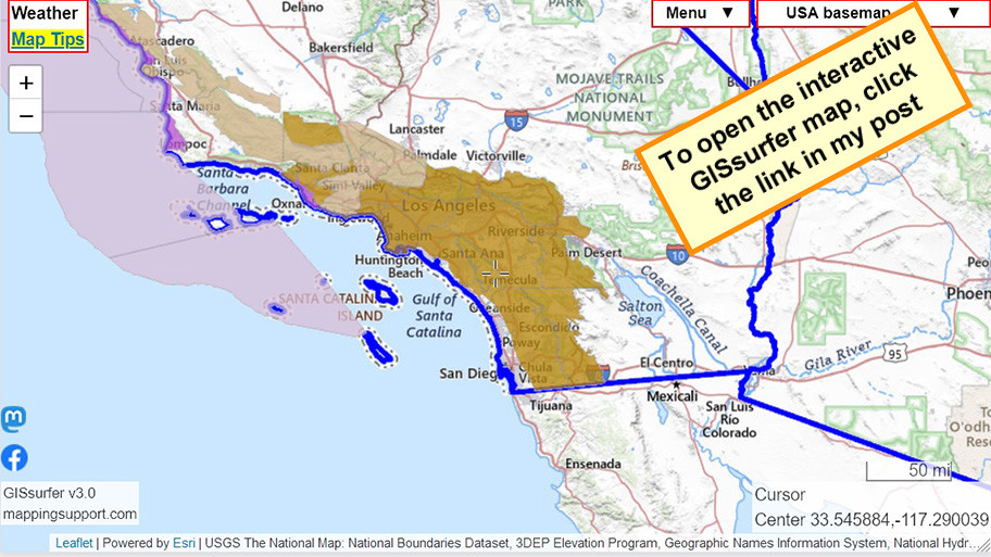
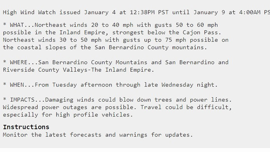
To read details from NOAA, open the map, click colored area, follow the link. Scroll down in the popup since the spot you clicked might have more than one type of weather watch/warning and each one has its own link for the details.
#CAwx
Open GISsurfer map:
https://mappingsupport.com/p2/gissurfer.php?center=33.545884,-117.290039&zoom=7&basemap=USA_basemap&overlay=State_boundary,Weather_watch_warning&data=https://mappingsupport.com/p2/special_maps/disaster/USA_weather.txt