Event JSON
{
"id": "397da098d3a96bcd091375a0d81187de963f848870525648a4e4407a5ff030a5",
"pubkey": "629d8ab7f64f44d697e368c3e0227675ffc3556b5b6481931c629e2d2cdd924a",
"created_at": 1739143758,
"kind": 1,
"tags": [
[
"t",
"sierra"
],
[
"t",
"mountains"
],
[
"t",
"blackandwhite"
],
[
"t",
"landscape"
],
[
"t",
"photography"
],
[
"t",
"darktable"
],
[
"imeta",
"url https://cdn.fosstodon.org/media_attachments/files/113/976/440/837/220/330/original/ad8e5fffdae73996.jpg",
"m image/jpeg",
"dim 1200x648",
"blurhash UgF68|-;t7of~q%Mt7oft7ofj[ofayayWBay"
],
[
"proxy",
"https://fosstodon.org/users/elaterite/statuses/113976525368628747",
"activitypub"
]
],
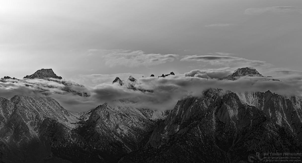
"content": "The Sierra Nevada with Lone Pine peak 3,947m (12,949ft) on the left, the Whitney Group in the middle, and Mt. Russell 4,296m (14,094ft) on the right. Mt. Whitney, the tallest peak in the lower 48 states, is 4,421m (14,505ft). It can be seen on the right end of the saw tooth series of peaks in the middle of the frame.\n\n#Sierra #Mountains #BlackAndWhite #Landscape #Photography #Darktable\n\nhttps://cdn.fosstodon.org/media_attachments/files/113/976/440/837/220/330/original/ad8e5fffdae73996.jpg",
"sig": "bbad2be217b1fcc096fd3537ab188cc3a130ec75e175f0b4171b635785c0bceaf89a24c701fb81f1289b0ccb3ff9c556e53d9fa11682fb0c3a5c39dbbdc1cd05"
}