
Mapping Support on Nostr: Like trails? In general, the Open Street Map (OSM) project has the most extensive and ...
Like trails?
In general, the Open Street Map (OSM) project has the most extensive and current trail data. The Open Topo Map (OTM) project has made map ‘tiles’ that software developers can display. Those map tiles include the OSM trail data and related information.
Adding government #GIS trail data from https://www.usgs.gov/national-digital-trails can make the trails on the OTM map ‘tiles’ easier to see at certain zoom levels, particularly on cell phones.
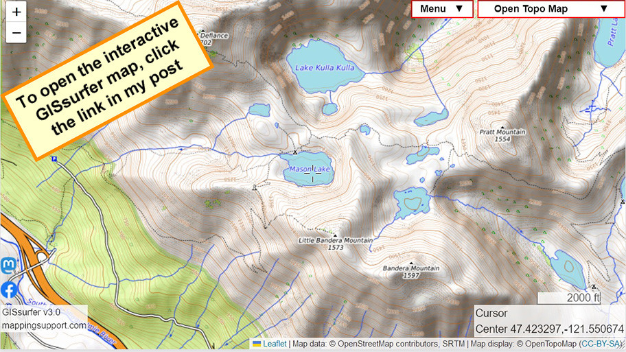
GISsurfer map - no GIS data
https://bit.ly/4aGxpYY
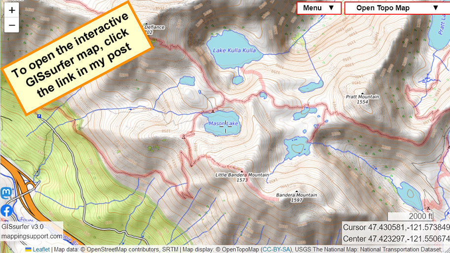
GISsurfer map with GIS trail data
https://bit.ly/3NLN2ob
When I finish GeoJPG v2 you will be able to make your own custom *offline* #maps that show this data. #mapping #hiking #OSM
In general, the Open Street Map (OSM) project has the most extensive and current trail data. The Open Topo Map (OTM) project has made map ‘tiles’ that software developers can display. Those map tiles include the OSM trail data and related information.
Adding government #GIS trail data from https://www.usgs.gov/national-digital-trails can make the trails on the OTM map ‘tiles’ easier to see at certain zoom levels, particularly on cell phones.
GISsurfer map - no GIS data
https://bit.ly/4aGxpYY
GISsurfer map with GIS trail data
https://bit.ly/3NLN2ob
When I finish GeoJPG v2 you will be able to make your own custom *offline* #maps that show this data. #mapping #hiking #OSM