
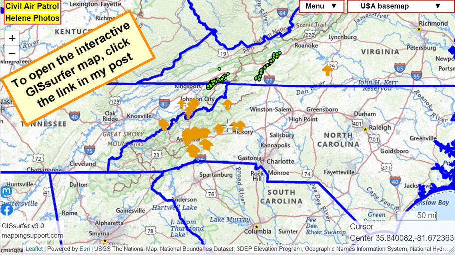
Mapping Support on Nostr: Outstanding work by the Civil Air Patrol taking low level super detailed photos of ...
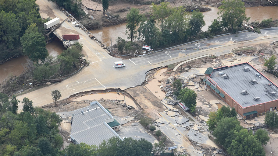
Outstanding work by the Civil Air Patrol taking low level super detailed photos of the damage caused by #Helene in western North Carolina and the nearby part of Tennessee.
#Asheville
Open the map and zoom in. There are a ton of photos. Click a symbol and follow the link to see the pic.
To search on an address click Menu > Search.
There are GIS overlays you can turn on that show county boundaries and county names. If you need help using GISsurfer I made a bunch of videos that you can find at
https://mappingsupport.com/p2/gissurfer-help.html
Open #GISsurfer map:
https://mappingsupport.com/p2/gissurfer.php?center=35.840082,-81.672363&zoom=7&basemap=USA_basemap&overlay=State_boundary,Civil_Air_Patrol&data=https://mappingsupport.com/p2/special_maps/disaster/civil_air_patrol/2024_helene_photos.txt