
Mapping Support on Nostr: For near real-time data on storm surge, open this interactive #GIS map, click any ...
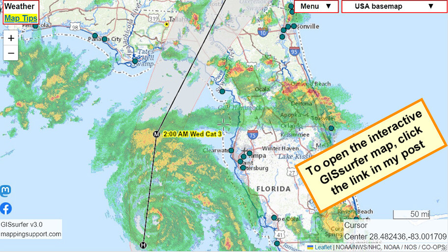
For near real-time data on storm surge, open this interactive #GIS map, click any green dot and follow the link. Each dot is a coastal gage. The gage directly above the map center is at #CedarKey
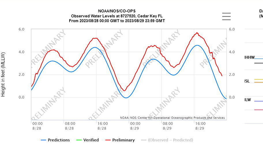
Each time you open a gage data page you will see the latest data.
Each gage data page also has “Meteorlogical Obs” link with near real-time wind speed data.
#Idalia #HurricaneIdalia #Hurricane #Florida #FLwx #GAwx #Geospatial
Open GISsurfer map:
https://mappingsupport.com/p2/gissurfer.php?center=28.482436,-83.001709&zoom=7&basemap=USA_basemap&overlay=Forecast_error_cone,USA_weather_radar,Hurricane/Storm_observed_track,Hurricane/Storm_observed_position,Hurricane/Storm_forecast_track,Hurricane/Storm_forecast_position,Coastal_gage&data=https://mappingsupport.com/p2/special_maps/disaster/USA_weather.txt